
Thank you for supporting this site ❤️
Make a donation
Make a donation
White Bear Township topographic map
Click on the map to display elevation.
Thank you for supporting this site ❤️
Make a donation
Make a donation
About this map
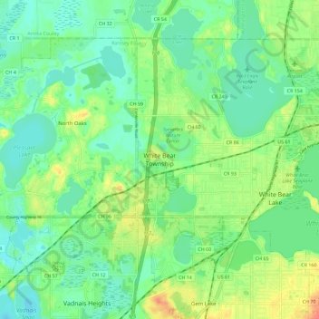
Name: White Bear Township topographic map, elevation, terrain.
Average elevation: 282 m
Minimum elevation: 266 m
Maximum elevation: 310 m
Thank you for supporting this site ❤️
Make a donation
Make a donation
Other topographic maps
Click on a map to view its topography, its elevation and its terrain.
Thank you for supporting this site ❤️
Make a donation
Make a donation
South Saint Anthony Park
United States > Minnesota > Ramsey County > Saint Paul
Average elevation: 270 m
Thank you for supporting this site ❤️
Make a donation
Make a donation