
Nedumpana topographic map
Interactive map
Click on the map to display elevation.
Nedumpana
Nedumpana is a countryside in Kollam district featuring a typical kerala village consisting paddy fields, wetlands, river channels and highlands. The area can be categorised into Ida Nadu (Mid land or plains) with an average elevation of 108 meter above mean sea level. Laterite soil and Alluvial Soil constitutes the major soil types. Major rainy season is the South West Monsoon, which bring about 130cm of rain. Out of the total area , 6276 acres of land is culturable.
About this map
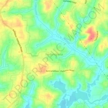
Name: Nedumpana topographic map, elevation, terrain.
Location: Nedumpana, Kollam, Kerala, 691580, India (8.88875 76.67450 8.92875 76.71450)
Average elevation: 26 m
Minimum elevation: 1 m
Maximum elevation: 60 m