
Make a donation
Nebringen topographic map
Click on the map to display elevation.
Make a donation
About this map
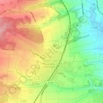
Name: Nebringen topographic map, elevation, terrain.
Average elevation: 458 m
Minimum elevation: 387 m
Maximum elevation: 528 m
Make a donation
Other topographic maps
Click on a map to view its topography, its elevation and its terrain.
Herrenberg
Deutschland > Baden-Württemberg > Landkreis Böblingen
Herrenberg liegt am Fuß des Schlossbergs, eines Ausläufers des Schönbuchs in das Korngäu bzw. Obere Gäu. Im westlichen Stadtgebiet entspringt die Ammer, ein kleiner linker Nebenfluss des Neckars. Das gesamte Kernstadtgebiet Herrenbergs liegt in einer Senke zwischen dem Schönbuch im Osten, den…
Average elevation: 479 m
Waldenbuch
Deutschland > Baden-Württemberg > Landkreis Böblingen > Waldenbuch > Waldenbuch
Average elevation: 428 m
Make a donation
Breitenstein
Deutschland > Baden-Württemberg > Landkreis Böblingen
Weil im Schönbuch liegt auf der Schönbuchlichtung zwischen 432 und 487 Metern Höhe, rund 30 Kilometer südwestlich von Stuttgart, zwölf Kilometer südlich von Böblingen und etwa 15 Kilometer nördlich von Tübingen an der Bundesstraße 464 von Böblingen nach Tübingen am Nordrand des Naturparks…
Average elevation: 460 m
Wasenhof
Deutschland > Baden-Württemberg > Landkreis Böblingen > Weil der Stadt
Average elevation: 444 m
Make a donation
Merklingen
Deutschland > Baden-Württemberg > Landkreis Böblingen > Weil der Stadt
Average elevation: 436 m
Kuppelzen
Deutschland > Baden-Württemberg > Landkreis Böblingen > Weil der Stadt
Average elevation: 473 m
Make a donation
Unterjettingen
Deutschland > Baden-Württemberg > Landkreis Böblingen
Zur ehemaligen Gemeinde Oberjettingen gehören das Dorf Oberjettingen, verschiedene Weiler (darunter Höhenhöfe) und Einzelsiedlungen sowie die abgegangenen Ortschaften Oberstetten, Im Weiler und Steinberg. Nordwestlich von Oberjettingen befinden sich zudem zwei Wassertürme sowie nordöstlich das Umspannwerk…
Average elevation: 556 m
Burschelberg
Deutschland > Baden-Württemberg > Landkreis Böblingen > Döffingen
Average elevation: 459 m
Make a donation
Schafhausen
Deutschland > Baden-Württemberg > Landkreis Böblingen > Weil der Stadt > Schafhausen
Average elevation: 459 m
Make a donation