
Thank you for supporting this site ❤️
Make a donation
Make a donation
Puttalam topographic map
Click on the map to display elevation.
Thank you for supporting this site ❤️
Make a donation
Make a donation
About this map
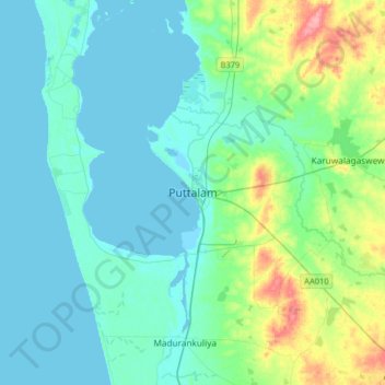
Name: Puttalam topographic map, elevation, terrain.
Location: Puttalam, Puttalam District, North Western Province, Sri Lanka (7.87019 79.66866 8.19019 79.98866)
Average elevation: 18 m
Minimum elevation: -1 m
Maximum elevation: 98 m
Thank you for supporting this site ❤️
Make a donation
Make a donation