
澜沧县 topographic map
Interactive map
Click on the map to display elevation.
About this map
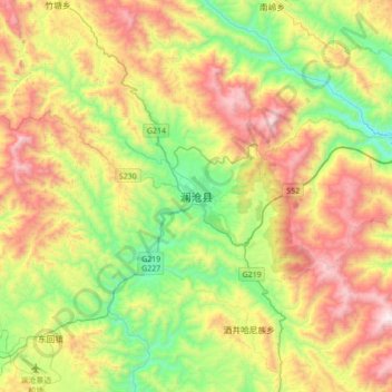
Name: 澜沧县 topographic map, elevation, terrain.
Location: 澜沧县, 澜沧拉祜族自治县, 普洱市, 云南省, 中国 (22.39662 99.76755 22.71662 100.08755)
Average elevation: 1,438 m
Minimum elevation: 846 m
Maximum elevation: 2,305 m
Other topographic maps
Click on a map to view its topography, its elevation and its terrain.