
Murten topographic map
Interactive map
Click on the map to display elevation.
About this map
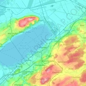
Name: Murten topographic map, elevation, terrain.
Location: Murten, Seebezirk, Freiburg, Schweiz (46.88224 7.08265 46.98633 7.21044)
Average elevation: 480 m
Minimum elevation: 423 m
Maximum elevation: 652 m
Other topographic maps
Click on a map to view its topography, its elevation and its terrain.
Mont Vully
Schweiz > Freiburg > Seebezirk > Wistenlach
Mont Vully, Wistenlach, Seebezirk, Freiburg, 1788, Schweiz
Average elevation: 487 m