
Verrayes topographic map
Interactive map
Click on the map to display elevation.
About this map
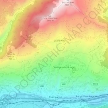
Name: Verrayes topographic map, elevation, terrain.
Location: Verrayes, Valle d'Aosta, Italië (45.73779 7.49146 45.80079 7.56883)
Average elevation: 1,263 m
Minimum elevation: 459 m
Maximum elevation: 2,446 m