
Thank you for supporting this site ❤️
Make a donation
Make a donation
Sitra topographic map
Click on the map to display elevation.
Thank you for supporting this site ❤️
Make a donation
Make a donation
About this map
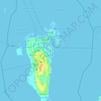
Name: Sitra topographic map, elevation, terrain.
Location: Sitra, Riffa, Southern Governorate, 626, Bahrain (25.83202 50.30154 26.47202 50.94154)
Average elevation: 2 m
Minimum elevation: -3 m
Maximum elevation: 108 m
Thank you for supporting this site ❤️
Make a donation
Make a donation