
Acherkogel topographic map
Interactive map
Click on the map to display elevation.
About this map
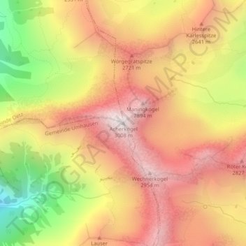
Name: Acherkogel topographic map, elevation, terrain.
Location: Acherkogel, Gemeinde Umhausen, Bezirk Imst, Tirol, Österreich (47.18916 10.95660 47.18926 10.95670)
Average elevation: 2,426 m
Minimum elevation: 1,645 m
Maximum elevation: 2,969 m
Other topographic maps
Click on a map to view its topography, its elevation and its terrain.
Umhausen
Österreich > Tirol > Bezirk Imst > Gemeinde Umhausen
Umhausen, Gemeinde Umhausen, Bezirk Imst, Tirol, 6441, Österreich
Average elevation: 1,385 m