
Casa Branca topographic map
Interactive map
Click on the map to display elevation.
About this map
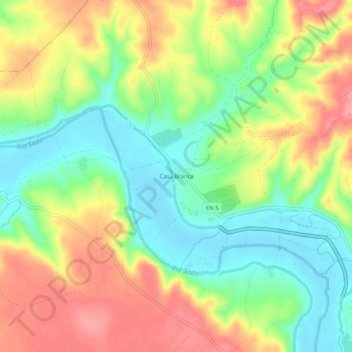
Name: Casa Branca topographic map, elevation, terrain.
Location: Casa Branca, Torrão, Alcácer do Sal, Setúbal, Portugal (38.26280 -8.42044 38.30280 -8.38044)
Average elevation: 45 m
Minimum elevation: 3 m
Maximum elevation: 94 m