
Big Trout Lake topographic map
Interactive map
Click on the map to display elevation.
About this map
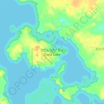
Name: Big Trout Lake topographic map, elevation, terrain.
Location: Big Trout Lake, Kenora District, Ontario, Canada (53.78311 -89.93055 53.86311 -89.85055)
Average elevation: 212 m
Minimum elevation: 206 m
Maximum elevation: 229 m