
Sustenhorn topographic map
Interactive map
Click on the map to display elevation.
About this map
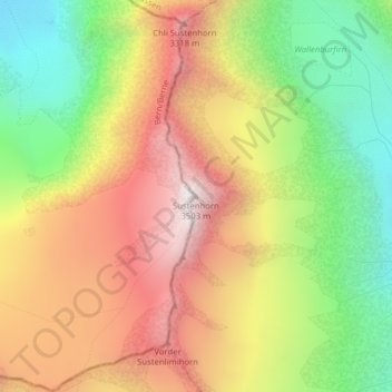
Name: Sustenhorn topographic map, elevation, terrain.
Location: Sustenhorn, Göschenen, Uri, 6487, Schweiz (46.69887 8.45515 46.69897 8.45525)
Average elevation: 2,857 m
Minimum elevation: 2,242 m
Maximum elevation: 3,480 m