
Las Fuentes topographic map
Interactive map
Click on the map to display elevation.
About this map
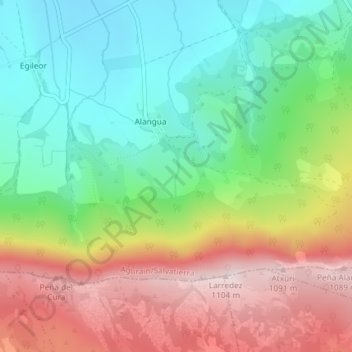
Name: Las Fuentes topographic map, elevation, terrain.
Average elevation: 820 m
Minimum elevation: 627 m
Maximum elevation: 1,093 m
Other topographic maps
Click on a map to view its topography, its elevation and its terrain.
Zadorra
España > País Vasco > Salvatierra
Zadorra, Salvatierra, Llanada Alavesa, Álava, País Vasco, 01207, España
Average elevation: 604 m