
Parumala topographic map
Interactive map
Click on the map to display elevation.
About this map
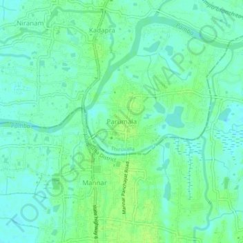
Name: Parumala topographic map, elevation, terrain.
Location: Parumala, Thiruvalla, Pathanamthitta, Kerala, 689626, India (9.30749 76.51839 9.34749 76.55839)
Average elevation: 6 m
Minimum elevation: 0 m
Maximum elevation: 11 m
Other topographic maps
Click on a map to view its topography, its elevation and its terrain.
Kizhakkummuri
India > Kerala > Thiruvalla > Kadapra
Kizhakkummuri, Kadapra, Thiruvalla, Pathanamthitta District, Kerala, India
Average elevation: 5 m
Mepral
India > Kerala > Thiruvalla
Mepral, Thiruvalla, Pathanamthitta District, Kerala, India
Average elevation: 2 m
Thiruvalla
India > Kerala > Thiruvalla
Thiruvalla, Pathanamthitta District, Kerala, 689111, India
Average elevation: 10 m