
Pajares topographic map
Interactive map
Click on the map to display elevation.
About this map
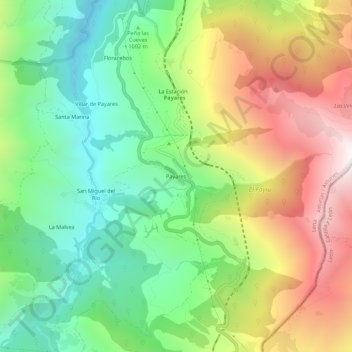
Name: Pajares topographic map, elevation, terrain.
Location: Pajares, Lena, Asturias, 33693, España (42.99795 -5.79264 43.03795 -5.75264)
Average elevation: 1,178 m
Minimum elevation: 642 m
Maximum elevation: 1,956 m
Other topographic maps
Click on a map to view its topography, its elevation and its terrain.