
Namsang topographic map
Interactive map
Click on the map to display elevation.
About this map
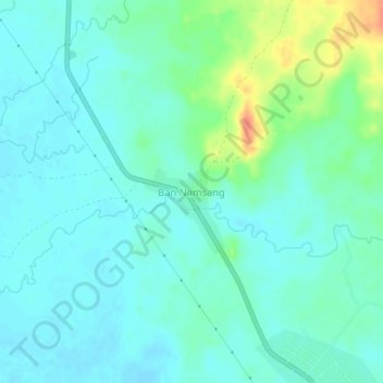
Name: Namsang topographic map, elevation, terrain.
Location: Namsang, Pakkading District, Bolikhamsai, Laos (18.10847 104.24637 18.14847 104.28637)
Average elevation: 162 m
Minimum elevation: 150 m
Maximum elevation: 199 m