
Cafayate topographic map
Interactive map
Click on the map to display elevation.
About this map
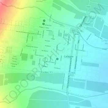
Name: Cafayate topographic map, elevation, terrain.
Location: Cafayate, Salta, A4427AHB, Argentina (-26.08157 -65.99809 -26.06313 -65.97075)
Average elevation: 1,633 m
Minimum elevation: 1,603 m
Maximum elevation: 1,708 m