
Évoramonte topographic map
Interactive map
Click on the map to display elevation.
About this map
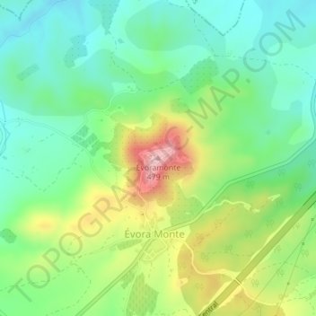
Name: Évoramonte topographic map, elevation, terrain.
Location: Évoramonte, Estremoz, Évora, 7100-308, Portugal (38.77185 -7.71585 38.77195 -7.71575)
Average elevation: 328 m
Minimum elevation: 248 m
Maximum elevation: 478 m
Other topographic maps
Click on a map to view its topography, its elevation and its terrain.
Caldeireiros
Caldeireiros, Estremoz, Évora, 7100-032, Portugal
Average elevation: 458 m
Santa Maria
Santa Maria, Estremoz, Évora, Portugal
Average elevation: 336 m
Ameixial (Santa Vitória e São Bento)
Ameixial (Santa Vitória e São Bento), Estremoz, Évora, Portugal
Average elevation: 290 m