
Moulin d'En Bas topographic map
Interactive map
Click on the map to display elevation.
About this map
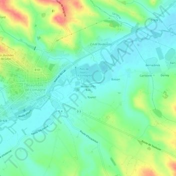
Name: Moulin d'En Bas topographic map, elevation, terrain.
Average elevation: 123 m
Minimum elevation: 96 m
Maximum elevation: 183 m
Other topographic maps
Click on a map to view its topography, its elevation and its terrain.
Derrey
France > Occitanie > Tarn-et-Garonne > Beaumont-de-Lomagne
Derrey, Beaumont-de-Lomagne, Castelsarrasin, Tarn-et-Garonne, Occitanie, France métropolitaine, 82500, France
Average elevation: 137 m