
Neuholland topographic map
Interactive map
Click on the map to display elevation.
About this map
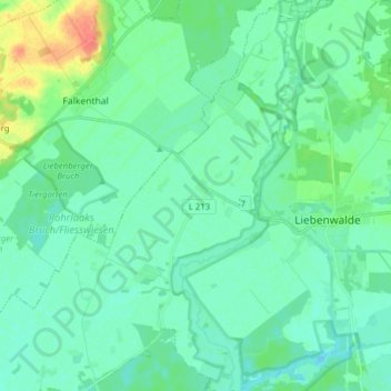
Name: Neuholland topographic map, elevation, terrain.
Location: Neuholland, Liebenwalde, Oberhavel, Brandenburg, Deutschland (52.83115 13.27394 52.92555 13.38203)
Average elevation: 43 m
Minimum elevation: 32 m
Maximum elevation: 82 m