
Thank you for supporting this site ❤️
Make a donation
Make a donation
Jasper topographic map
Click on the map to display elevation.
Thank you for supporting this site ❤️
Make a donation
Make a donation
About this map
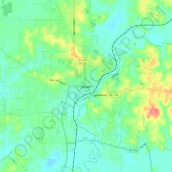
Name: Jasper topographic map, elevation, terrain.
Location: Jasper, Dubois County, Indiana, 47546, United States (38.35142 -86.97087 38.43142 -86.89087)
Average elevation: 150 m
Minimum elevation: 130 m
Maximum elevation: 200 m
Thank you for supporting this site ❤️
Make a donation
Make a donation
Other topographic maps
Click on a map to view its topography, its elevation and its terrain.