
Lac Notre-Dame topographic map
Interactive map
Click on the map to display elevation.
About this map
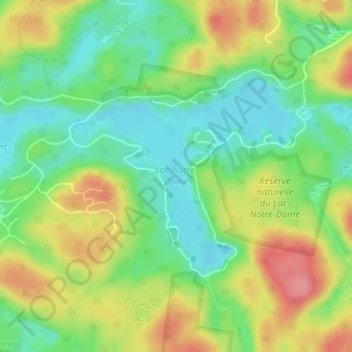
Name: Lac Notre-Dame topographic map, elevation, terrain.
Average elevation: 406 m
Minimum elevation: 367 m
Maximum elevation: 458 m
Other topographic maps
Click on a map to view its topography, its elevation and its terrain.
Lac Édouard
Canada > Québec > Les Pays-d'en-Haut > Wentworth-Nord
Lac Édouard, Wentworth-Nord, Les Pays-d'en-Haut, Laurentides, Québec, Canada
Average elevation: 404 m
Lac Saint-François-Xavier
Canada > Québec > Les Pays-d'en-Haut > Wentworth-Nord > Montfort
Lac Saint-François-Xavier, Montfort, Wentworth-Nord, Les Pays-d'en-Haut, Laurentides, Québec, Canada
Average elevation: 426 m