
Hodgenville topographic map
Interactive map
Click on the map to display elevation.
About this map
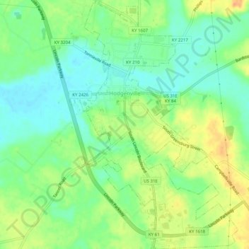
Name: Hodgenville topographic map, elevation, terrain.
Location: Hodgenville, Larue County, Kentucky, VS (37.54918 -85.75166 37.58836 -85.71784)
Average elevation: 229 m
Minimum elevation: 213 m
Maximum elevation: 250 m