
Kickelhahn topographic map
Interactive map
Click on the map to display elevation.
About this map
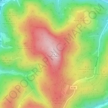
Name: Kickelhahn topographic map, elevation, terrain.
Location: Kickelhahn, Ilmenau, Ilm-Kreis, Turíngia, 98714, Alemanha (50.65583 10.87106 50.67583 10.89106)
Average elevation: 687 m
Minimum elevation: 513 m
Maximum elevation: 855 m