
Thank you for supporting this site ❤️
Make a donation
Make a donation
Nagzari topographic map
Click on the map to display elevation.
Thank you for supporting this site ❤️
Make a donation
Make a donation
About this map
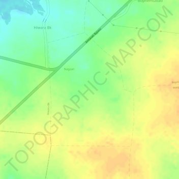
Name: Nagzari topographic map, elevation, terrain.
Location: Nagzari, Nandgaon-Khandeshwar, Amravati, Maharashtra, India (20.75487 77.63356 20.77202 77.64742)
Average elevation: 333 m
Minimum elevation: 313 m
Maximum elevation: 345 m
Thank you for supporting this site ❤️
Make a donation
Make a donation
Other topographic maps
Click on a map to view its topography, its elevation and its terrain.
Nandgaon Khandeshwar
India > Maharashtra > Nandgaon-Khandeshwar > Nandgaon Khandeshwar
Average elevation: 302 m