
Fariñentu topographic map
Interactive map
Click on the map to display elevation.
About this map
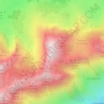
Name: Fariñentu topographic map, elevation, terrain.
Location: Fariñentu, Quirós, Asturies, 33628, Espagne (43.04085 -5.93562 43.04095 -5.93552)
Average elevation: 1,751 m
Minimum elevation: 1,204 m
Maximum elevation: 2,161 m
Other topographic maps
Click on a map to view its topography, its elevation and its terrain.