
Lüderbach topographic map
Interactive map
Click on the map to display elevation.
About this map
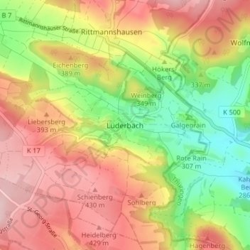
Name: Lüderbach topographic map, elevation, terrain.
Location: Lüderbach, Ringgau, Werra-Meißner-Kreis, Hessen, Deutschland (51.05354 10.11431 51.09354 10.15431)
Average elevation: 357 m
Minimum elevation: 250 m
Maximum elevation: 451 m