
Ghomrassen topographic map
Interactive map
Click on the map to display elevation.
About this map
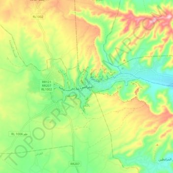
Name: Ghomrassen topographic map, elevation, terrain.
Location: Ghomrassen, الواحة, معتمدية غمراسن, Tataouine, 3220, Tunisia (33.01990 10.29906 33.09990 10.37906)
Average elevation: 325 m
Minimum elevation: 227 m
Maximum elevation: 463 m
Other topographic maps
Click on a map to view its topography, its elevation and its terrain.