
Thank you for supporting this site ❤️
Make a donation
Make a donation
Levan topographic map
Click on the map to display elevation.
Thank you for supporting this site ❤️
Make a donation
Make a donation
About this map
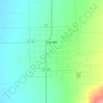
Name: Levan topographic map, elevation, terrain.
Location: Levan, Juab County, Utah, United States (39.54941 -111.86942 39.56264 -111.84874)
Average elevation: 1,624 m
Minimum elevation: 1,596 m
Maximum elevation: 1,695 m
Thank you for supporting this site ❤️
Make a donation
Make a donation
Other topographic maps
Click on a map to view its topography, its elevation and its terrain.