
Granite Peak topographic map
Interactive map
Click on the map to display elevation.
About this map
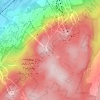
Name: Granite Peak topographic map, elevation, terrain.
Average elevation: 332 m
Minimum elevation: 123 m
Maximum elevation: 449 m
Other topographic maps
Click on a map to view its topography, its elevation and its terrain.
Pinwheel Vista
United States > New Jersey > Sussex County > Vernon Township
Pinwheel Vista, Blue Trail, Vernon Township, Sussex County, New Jersey, 07422, United States
Average elevation: 279 m
Glenwood
United States > New Jersey > Sussex County > Vernon Township
Glenwood, Vernon Township, Sussex County, New Jersey, 07418, United States
Average elevation: 206 m