Geolocate

Pennal topographic map

Interactive map

Click on the map to display elevation.

About this map

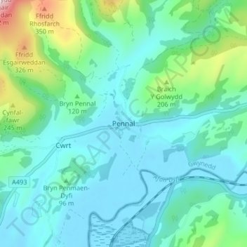
Name: Pennal topographic map, elevation, terrain.

Location: Pennal, Gwynedd, Wales, SY20 9DH, United Kingdom (52.56624 -3.94003 52.60624 -3.90003)

Average elevation: 89 m

Minimum elevation: -2 m

Maximum elevation: 476 m

Other topographic maps

Click on a map to view its topography, its elevation and its terrain.

Snowdon

United Kingdom > Wales > Gwynedd > Betws Garmon

Snowdon, Llanberis Path, Betws Garmon, Gwynedd, Wales, LL55 4UL, United Kingdom

Average elevation: 692 m

Treborth-uchaf-Farm

United Kingdom > Wales > Gwynedd > Menai Bridge > Treborth-uchaf-Farm

Treborth-uchaf-Farm, Pentir, Menai Bridge, Gwynedd, Wales, LL57 2NX, United Kingdom

Average elevation: 48 m