
Galtern topographic map
Interactive map
Click on the map to display elevation.
About this map
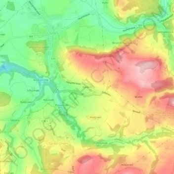
Name: Galtern topographic map, elevation, terrain.
Location: Galtern, Tafers, Sensebezirk, Freiburg, 1712, Schweiz (46.78290 7.20800 46.82290 7.24800)
Average elevation: 703 m
Minimum elevation: 602 m
Maximum elevation: 806 m