
Baijnath topographic map
Interactive map
Click on the map to display elevation.
About this map
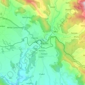
Name: Baijnath topographic map, elevation, terrain.
Location: Baijnath, Kangra, Himachal Pradesh, India (32.01041 76.60295 32.09041 76.68295)
Average elevation: 1,069 m
Minimum elevation: 799 m
Maximum elevation: 1,768 m