
Make a donation
Puyallup topographic map
Click on the map to display elevation.
Make a donation
Puyallup
Downtown Puyallup and nearby neighborhoods lie within the hazard zone for lahars that could be produced in a moderate or large eruption of nearby Mount Rainier. The city's position on the Puyallup River is downstream of the western flank of Mount Rainier, which has the highest potential for producing far-traveled lahars due to the abundance of weakened clay-rich rock at high altitudes. The entire Puyallup Valley is built on deposits of the 5,600-year-old Osceola Mudflow, which deposited as much as 98 feet (30 m) of material and was similar to largest lahars Mount Rainier could produce. A 2009 study by the United States Geological Survey (USGS) determined that Puyallup has the highest number of dependent-population facilities, public venues, and overall community assets within lahar hazard zones. The Washington State Department of Natural Resources estimates that the Puyallup Valley could experience $6–12 billion in damage from a major lahar.
Make a donation
About this map
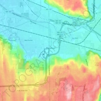
Name: Puyallup topographic map, elevation, terrain.
Location: Puyallup, Pierce County, Washington, United States (47.14731 -122.33789 47.21849 -122.23481)
Average elevation: 67 m
Minimum elevation: 4 m
Maximum elevation: 185 m
Make a donation
Other topographic maps
Click on a map to view its topography, its elevation and its terrain.