
Le Grand Frahaut topographic map
Interactive map
Click on the map to display elevation.
About this map
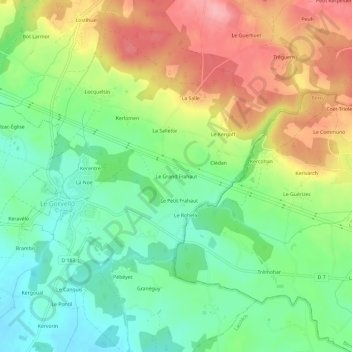
Name: Le Grand Frahaut topographic map, elevation, terrain.
Average elevation: 61 m
Minimum elevation: 12 m
Maximum elevation: 129 m
Other topographic maps
Click on a map to view its topography, its elevation and its terrain.
Keravello Les Pins
France > Bretagne > Morbihan > Sulniac
Keravello Les Pins, Sulniac, Vannes, Morbihan, Bretagne, France métropolitaine, 56250, France
Average elevation: 101 m
Les Vallons
France > Bretagne > Morbihan > Sulniac > Les Vallons
Les Vallons, Sulniac, Vannes, Morbihan, Bretagne, France métropolitaine, 56250, France
Average elevation: 112 m
Beg Er Lann
France > Bretagne > Morbihan > Sulniac
Beg Er Lann, Sulniac, Vannes, Morbihan, Bretagne, France métropolitaine, 56250, France
Average elevation: 120 m