
Thunersee topographic map
Interactive map
Click on the map to display elevation.
About this map
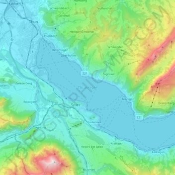
Name: Thunersee topographic map, elevation, terrain.
Average elevation: 899 m
Minimum elevation: 545 m
Maximum elevation: 2,352 m
Other topographic maps
Click on a map to view its topography, its elevation and its terrain.
Burgfeldstand
Burgfeldstand, Sigriswil, Verwaltungskreis Thun, Verwaltungsregion Oberland, Bern, 3803, Schweiz
Average elevation: 1,652 m