
Saharij topographic map
Interactive map
Click on the map to display elevation.
About this map
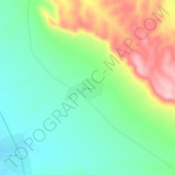
Name: Saharij topographic map, elevation, terrain.
Average elevation: 453 m
Minimum elevation: 380 m
Maximum elevation: 587 m
Other topographic maps
Click on a map to view its topography, its elevation and its terrain.
A`zaz
A`zaz, Azaz Subdistrict, Azaz District, Aleppo Governorate, Syria
Average elevation: 559 m
`Arbid
`Arbid, Eastern Kuweires Subdistrict, Deir Hafer ِِDistrict, Aleppo Governorate, Syria
Average elevation: 367 m
Diriyah
Syria > Aleppo Governorate > Diriyah
Diriyah, Al-Bab Subdistrict, al-Bab District, Aleppo Governorate, Syria
Average elevation: 515 m
Bi'r ash Shamli
Syria > Aleppo Governorate > Bi'r ash Shamli
Bi'r ash Shamli, Sarin Subdistrict, Ayn Al-Arab (Kobani) District, Aleppo Governorate, Syria
Average elevation: 436 m
Aleppo
Aleppo, Mount Simeon Subdistrict, Mount Simeon District, Aleppo Governorate, Syria
Average elevation: 413 m