
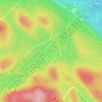
Lac Saint-Louis topographic map
Interactive map
Click on the map to display elevation.
About this map
Name: Lac Saint-Louis topographic map, elevation, terrain.
Average elevation: 443 m
Minimum elevation: 356 m
Maximum elevation: 528 m
Other topographic maps
Click on a map to view its topography, its elevation and its terrain.
Mont Jacqueline
Canada > Québec > Les Pays-d'en-Haut > Sainte-Marguerite-du-Lac-Masson
Mont Jacqueline, Sainte-Marguerite-du-Lac-Masson, Les Pays-d'en-Haut, Laurentides, Québec, J8B 0B8, Canada
Average elevation: 346 m
Rivière Doncaster
Canada > Québec > Les Pays-d'en-Haut > Sainte-Marguerite-du-Lac-Masson
Rivière Doncaster, Sainte-Marguerite-du-Lac-Masson, Les Pays-d'en-Haut, Laurentides, Québec, Canada
Average elevation: 377 m