
Thank you for supporting this site ❤️
Make a donation
Make a donation
Malvern Hill topographic map
Click on the map to display elevation.
Thank you for supporting this site ❤️
Make a donation
Make a donation
About this map
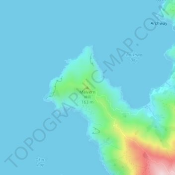
Name: Malvern Hill topographic map, elevation, terrain.
Location: Malvern Hill, Marlborough, New Zealand (-40.96905 173.79287 -40.96895 173.79297)
Average elevation: 36 m
Minimum elevation: 0 m
Maximum elevation: 363 m
Thank you for supporting this site ❤️
Make a donation
Make a donation
Other topographic maps
Click on a map to view its topography, its elevation and its terrain.