
Thank you for supporting this site ❤️
Make a donation
Make a donation
Ballard topographic map
Click on the map to display elevation.
Thank you for supporting this site ❤️
Make a donation
Make a donation
About this map
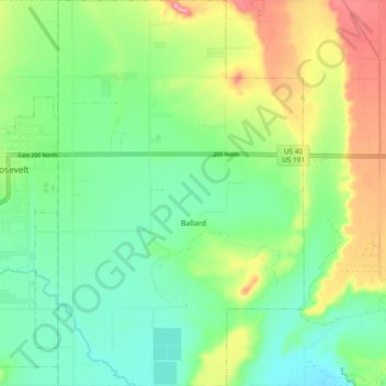
Name: Ballard topographic map, elevation, terrain.
Location: Ballard, Uintah County, Utah, United States (40.25866 -109.97661 40.33116 -109.91598)
Average elevation: 1,551 m
Minimum elevation: 1,503 m
Maximum elevation: 1,641 m
Thank you for supporting this site ❤️
Make a donation
Make a donation
Other topographic maps
Click on a map to view its topography, its elevation and its terrain.