
Rota topographic map
Interactive map
Click on the map to display elevation.
About this map
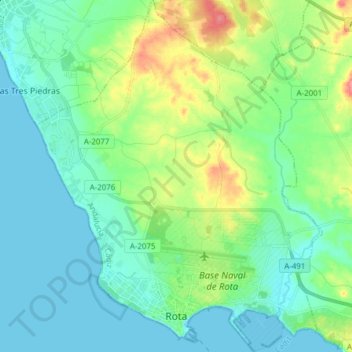
Name: Rota topographic map, elevation, terrain.
Location: Rota, Costa Noroeste, Cádiz, Andalusien, 11520, Spanien (36.61037 -6.42108 36.73351 -6.29615)
Average elevation: 18 m
Minimum elevation: -2 m
Maximum elevation: 71 m
Die Stadt liegt nördlich der Bucht von Cádiz. Die Höhenlage reicht vom Meeresniveau bis zu einer Höhe von 14 m im Zentrum.