
Thank you for supporting this site ❤️
Make a donation
Make a donation
Le Port d'Alon topographic map
Click on the map to display elevation.
Thank you for supporting this site ❤️
Make a donation
Make a donation
About this map
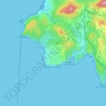
Name: Le Port d'Alon topographic map, elevation, terrain.
Average elevation: 30 m
Minimum elevation: 0 m
Maximum elevation: 212 m
Thank you for supporting this site ❤️
Make a donation
Make a donation
Other topographic maps
Click on a map to view its topography, its elevation and its terrain.
Plage des Nations
France > Provence-Alpes-Côte d'Azur > Var > Saint-Cyr-sur-Mer > Le Port d'Alon
Average elevation: 31 m