
Thank you for supporting this site ❤️
Make a donation
Make a donation
Stacy topographic map
Click on the map to display elevation.
Thank you for supporting this site ❤️
Make a donation
Make a donation
About this map
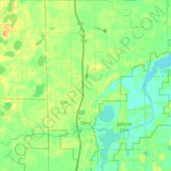
Name: Stacy topographic map, elevation, terrain.
Location: Stacy, Chisago County, Minnesota, United States (45.36908 -93.02168 45.47050 -92.89695)
Average elevation: 274 m
Minimum elevation: 261 m
Maximum elevation: 295 m
Thank you for supporting this site ❤️
Make a donation
Make a donation
Other topographic maps
Click on a map to view its topography, its elevation and its terrain.
Chain Lake
United States > Minnesota > Chisago County > North Branch > Harris
Average elevation: 281 m