Mamdapur topographic map
Interactive map
Click on the map to display elevation.
About this map
![Mamdapur topographic map, elevation, terrain](/pub/maps/relation/cn3q/6cc6tj/thumbnail.jpg)
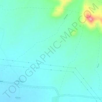
Name: Mamdapur topographic map, elevation, terrain.
Location: Mamdapur, Warud, Amravati, Maharashtra, India (21.37602 78.12286 21.39728 78.14817)
Average elevation: 370 m
Minimum elevation: 342 m
Maximum elevation: 479 m
Other topographic maps
Click on a map to view its topography, its elevation and its terrain.
![Warud topographic map, elevation, terrain](/pub/maps/relation/8g9m/n6d8kl/icon.jpg)
Warud
India > Maharashtra > Warud
Warud, Amravati District, Maharashtra, India
Average elevation: 402 m
![Shendurjana Ghat topographic map, elevation, terrain](/pub/maps/relation/7rt6/3bg7nx/icon.jpg)
Shendurjana Ghat
India > Maharashtra > Warud
Shendurjana Ghat, Warud, Amravati, Maharashtra, India
Average elevation: 430 m
![Sawangi topographic map, elevation, terrain](/pub/maps/relation/hkgp/5hprdn/icon.jpg)
Sawangi
India > Maharashtra > Warud
Sawangi, Warud, Amravati, Maharashtra, India
Average elevation: 396 m
![Goregaon topographic map, elevation, terrain](/pub/maps/relation/nm51/j44jgt/icon.jpg)
Goregaon
India > Maharashtra > Warud
Goregaon, Warud, Amravati, Maharashtra, India
Average elevation: 391 m