
Bottrop topographic map
Interactive map
Click on the map to display elevation.
About this map
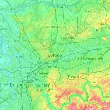
Name: Bottrop topographic map, elevation, terrain.
Average elevation: 57 m
Minimum elevation: 12 m
Maximum elevation: 239 m
Other topographic maps
Click on a map to view its topography, its elevation and its terrain.
Feldhausen
Duitsland > Noordrijn-Westfalen > Bottrop > Feldhausen
Feldhausen, Bottrop, Noordrijn-Westfalen, 45966, Duitsland
Average elevation: 55 m