
Thank you for supporting this site ❤️
Make a donation
Make a donation
Nagar topographic map
Click on the map to display elevation.
Thank you for supporting this site ❤️
Make a donation
Make a donation
About this map
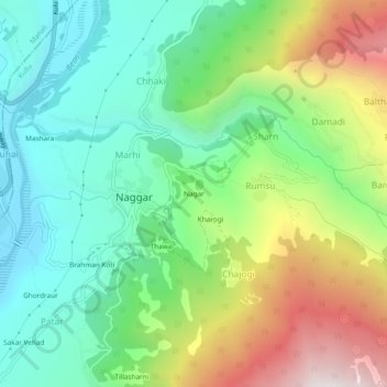
Name: Nagar topographic map, elevation, terrain.
Location: Nagar, Naggar, Kullu, Himachal Pradesh, 175130, India (32.09359 77.15132 32.13359 77.19132)
Average elevation: 1,930 m
Minimum elevation: 1,447 m
Maximum elevation: 2,850 m
Thank you for supporting this site ❤️
Make a donation
Make a donation