
Thank you for supporting this site ❤️
Make a donation
Make a donation
Galdola topographic map
Click on the map to display elevation.
Thank you for supporting this site ❤️
Make a donation
Make a donation
About this map
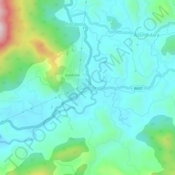
Name: Galdola topographic map, elevation, terrain.
Location: Galdola, Matara District, Southern Province, Sri Lanka (6.25921 80.52697 6.29921 80.56697)
Average elevation: 191 m
Minimum elevation: 90 m
Maximum elevation: 576 m
Thank you for supporting this site ❤️
Make a donation
Make a donation