
Thank you for supporting this site ❤️
Make a donation
Make a donation
Seraing topographic map
Click on the map to display elevation.
Thank you for supporting this site ❤️
Make a donation
Make a donation
About this map
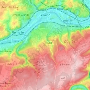
Name: Seraing topographic map, elevation, terrain.
Location: Seraing, Liège, Wallonia, 4100, Belgium (50.54723 5.46989 50.62861 5.56555)
Average elevation: 167 m
Minimum elevation: 55 m
Maximum elevation: 275 m
Thank you for supporting this site ❤️
Make a donation
Make a donation
Other topographic maps
Click on a map to view its topography, its elevation and its terrain.