
Thank you for supporting this site ❤️
Make a donation
Make a donation
Cornell topographic map
Click on the map to display elevation.
Thank you for supporting this site ❤️
Make a donation
Make a donation
About this map
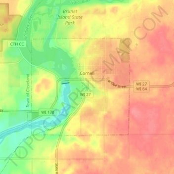
Name: Cornell topographic map, elevation, terrain.
Location: Cornell, Chippewa County, Wisconsin, United States (45.14826 -91.17482 45.17763 -91.10055)
Average elevation: 328 m
Minimum elevation: 287 m
Maximum elevation: 356 m
Thank you for supporting this site ❤️
Make a donation
Make a donation
Other topographic maps
Click on a map to view its topography, its elevation and its terrain.