
Arvier topographic map
Interactive map
Click on the map to display elevation.
About this map
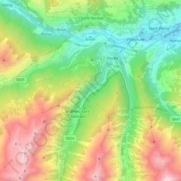
Name: Arvier topographic map, elevation, terrain.
Location: Arvier, Aosta Valley, 11011, Italy (45.62988 7.02237 45.70957 7.18753)
Average elevation: 1,638 m
Minimum elevation: 610 m
Maximum elevation: 3,446 m